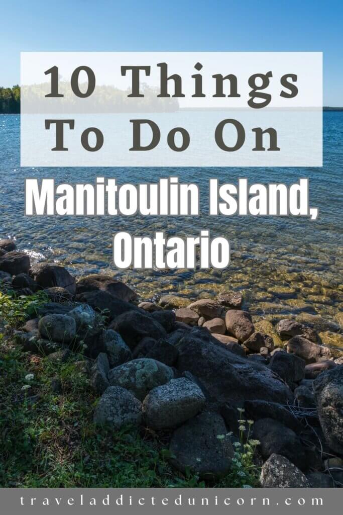
10 Things To Do On Manitoulin Island, Ontario 2026

Looking For The Best Things To Do On Manitoulin Island, Ontario? We’ve Got You Covered!
In this blog post, we will explore the 10 best things to do on Manitoulin Island, Ontario – the largest freshwater island in the world.
Manitoulin Island is located in Lake Huron and has 108 freshwater lakes on its territory.
Known as “Cave of the Spirit” to the Ojibwe people who have inhabited the region for centuries, Manitoulin Island is steeped in indigenous culture and traditions.
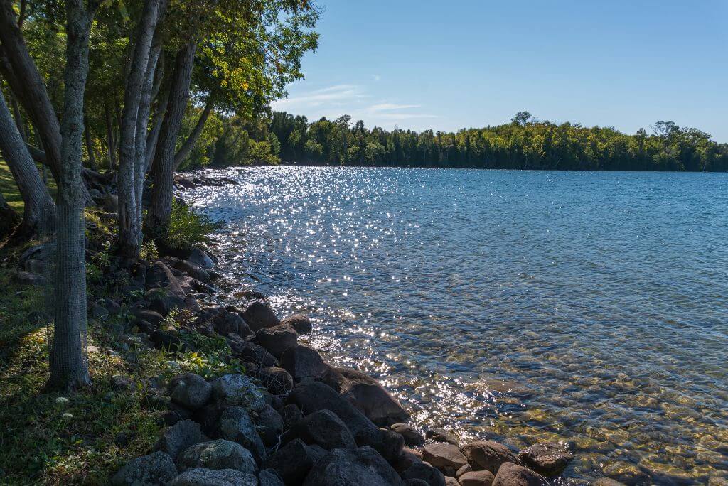
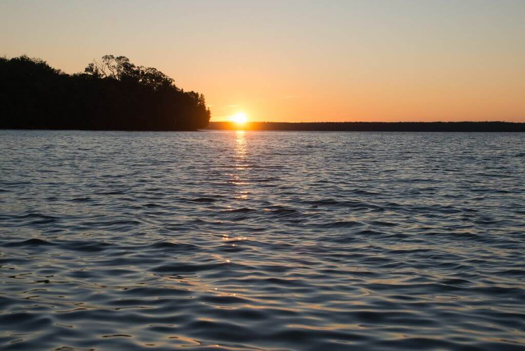
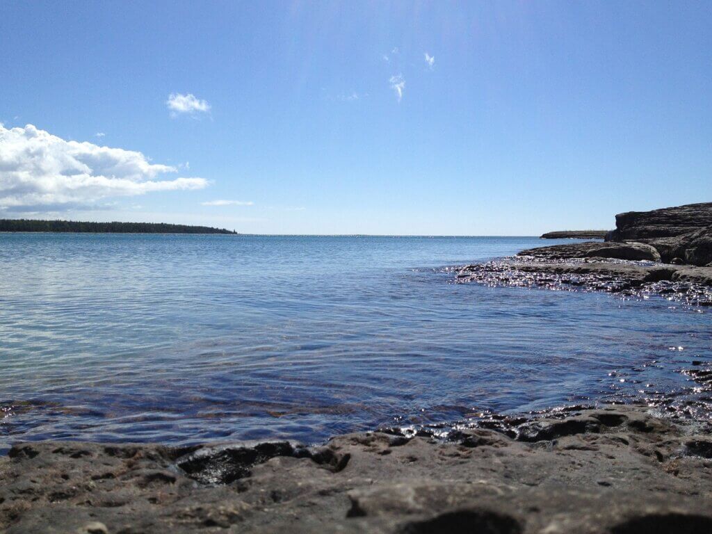
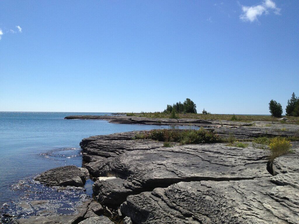
With its lush forests, rugged cliffs, and picturesque lakeshores, this island offers its visitors stunning natural landscapes.
There is a map of Manitoulin Island and the surrounding area at the end, which shows the location of all the things I have mentioned.
Recommended Resources:
🏢 Hotels
🏡 Cottage & Vacation Rentals
🚵🏼♀️ Tours
🚘 Car Rental
🩹 Travel Insurance
💧 Water Bottle
Things To Do On Manitoulin Island, Ontario
Let’s jump into the list of things to do on Manitoulin Island, with probably the most popular one.
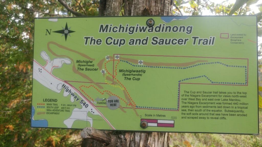
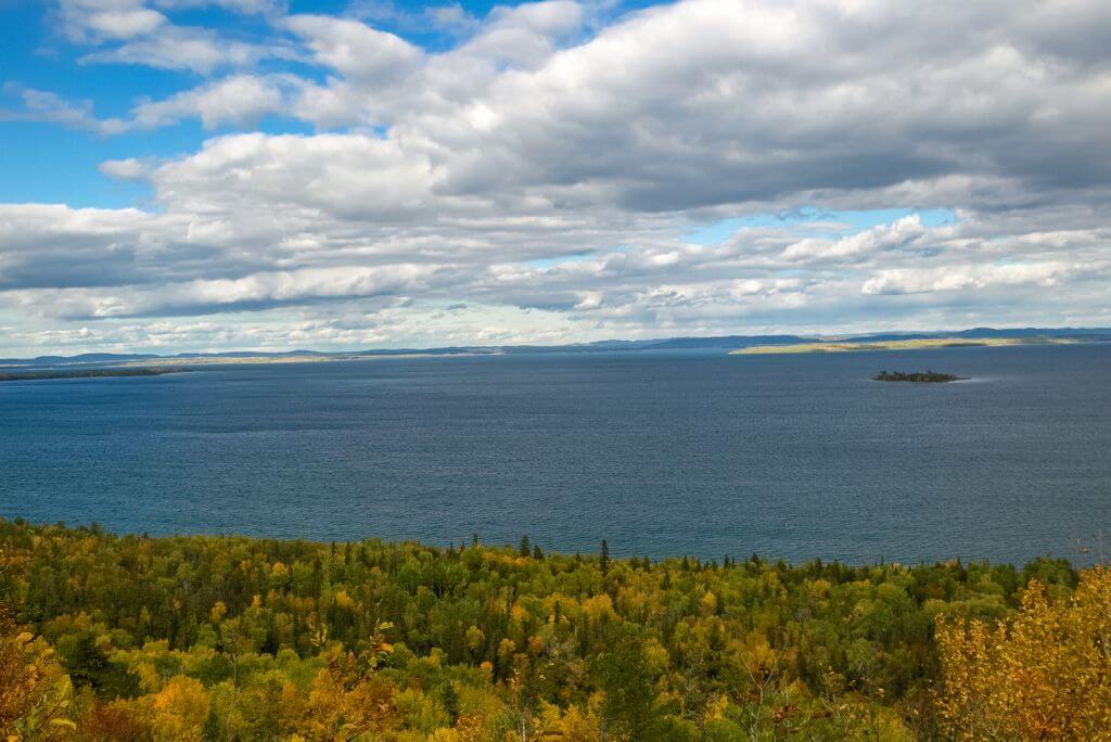
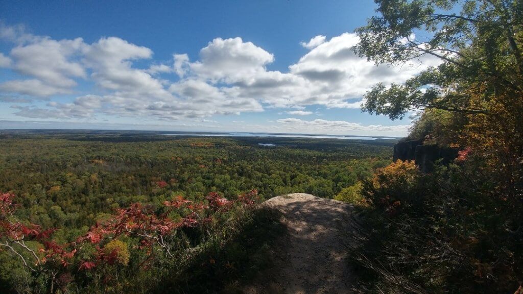
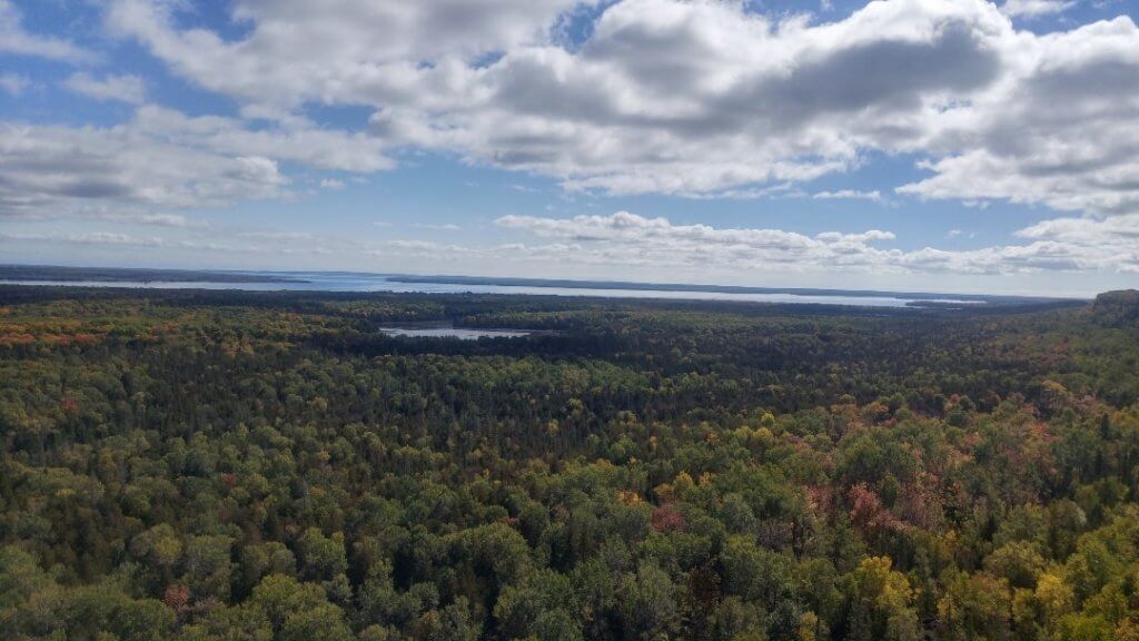
1. Cup And Saucer Trail
The Cup and Saucer Trail is one of Manitoulin Island’s most popular and iconic hiking trails.
Located in the Cup and Saucer Conservation Area near M’Chigeeng First Nation, this trail offers breathtaking panoramic views and a thrilling outdoor adventure for nature enthusiasts.
The trail derives its name from the unique geological formations that resemble a giant cup and saucer.
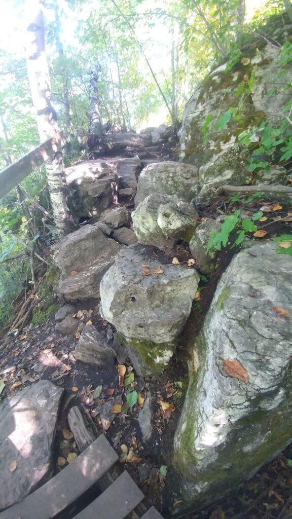
As you make your way up, you’ll encounter rugged limestone cliffs, deep crevices, and rock outcrops, all carved by the forces of nature over thousands of years.
The highlight of the trail is reaching the majestic lookout point at the top that offers sweeping vistas of Manitoulin Island’s stunning landscapes.
From there, you can marvel at the vast expanse of lush green forests, sparkling blue waters, and the surrounding islands dotting Lake Huron.
How long does it take to hike the Cup and Saucer?
The Cup and Saucer Trail caters to various hiking skill levels, with options for both moderate and challenging routes.
The main trail is the Red one and covers approximately 5 kilometers (return trip).
It can take around 1.5 to 2 hours to complete, depending on your pace and stops along the way.
There are two other trails – the Blue one, which adds another 1.5–2 km to your hike and the Yellow one, which is extremely adventurous.
The Blue one consists of ladders, tighter passages, and more technical sections.
Meanwhile, the Yellow Trail is quieter and less maintained, with rougher terrain, uneven footing, and a more rugged backcountry feel.

Most people do only the Red one, which is the easiest of the 3 Manitoulin Island hiking trails.
However, it’s important to note that the side trails (Blue and Yellow) are more challenging.
They should only be attempted by experienced hikers or those comfortable with rough terrain.
The paths are well-marked with signage and provide opportunities to rest and take in the natural beauty at designated viewpoints.
The first part of the Red Trail is pretty flat and easy; however, from the middle point to the top, there were sections that I found quite difficult.
In addition, there were two steep staircases as well as sections with large rocks obstructing the path.
What do you do when you get to the top?
Once you get to the top, the main trail path becomes a circle, which means you can go either way and it will be one big loop.
Before embarking on the Cup and Saucer Trail, it’s advisable to wear appropriate footwear and bring water, snacks, and insect repellent.
The trail is generally open from spring to autumn.
👉 Grab your own LARQ Bottle. The Nano Zero Filter technology removes lead, heavy metals, chlorine, microplastics, and other particulates in the water.
Is there parking or any facilities at the Cup and Saucer trail?
There is free parking at the bottom of the hike as well as a few porta-potties.
Once you leave the parking lot, there are no other amenities such as garbage cans, washrooms, or water stations.
You are welcome to bring your own food, but keep in mind you’re going to have to bring all of the garbage with you back to the parking lot.
How do I get to the Cup and Saucer Trail?
From the town of Little Current, head west on Highway 540 for approximately 20 kilometers (12 miles) until you reach Bidwell Road.
As you continue on Highway 540, you will come across the parking area and trailhead located on the east side of the road.
How hard is the Cup and Saucer Trail?
The main trail is considered moderate to moderately challenging, making it suitable for hikers with a reasonable level of fitness and some hiking experience.
The trail features some uphill sections, uneven terrain, and rocky pathways.
This applies to the Red (main trail) and the Blue one.
The Yellow Trail is adventurous and is meant for people with the proper equipment and extensive knowledge of hiking.
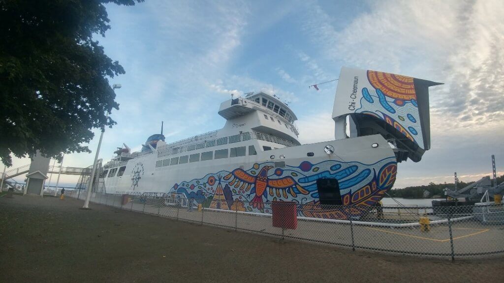
2. The Chi-Cheemaun Ferry
The Chi-Cheemaun Ferry connects Tobermory on the Bruce Peninsula with South Baymouth on Manitoulin Island.
The ferry is able to transport over 600 passengers and 140 vehicles.
As it sails through the Georgian Bay, you can see its stunning shorelines and blue waters.
Its name means “big canoe” in Ojibwe (an indigenous language spoken in the area).
This iconic vessel has become a beloved symbol of Manitoulin Island and is an integral part of the region’s transportation network, providing both a practical means of travel and a memorable experience for visitors.
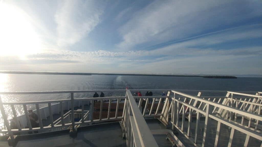
Onboard the ferry, you’ll find a range of amenities and services designed to enhance your travel experience.
Comfortable seating areas, observation decks, and outdoor seating allow passengers to relax and take in the surrounding beauty during the crossing.
Also, there are dining options available, including a cafeteria and a licensed dining area, where you can grab a meal or refreshments.
How long is the Chi-Cheemaun ferry ride?
The ride takes about 2 hours (40km) one way, it is smooth (you won’t get seasick) and well-organized.
In addition, the ferry usually runs from May to October.
Also, dogs are allowed on the ferry; they have to be leashed and must stay on the outside deck, especially in the summer.
The area around both terminals in Tobermory and South Baymouth is well-manicured, and it’s worth walking around before you get on the boat.
Don’t forget you will have to show up at the ferry terminal with your car at least an hour before departure.

In order to use the ferry, you would need to book online ahead of time.
When you book the ticket online, you will have to input a bunch of details about your vehicle, so make sure those are correct because if the reservation doesn’t match your car, your ticket might be void.
Once you disembark, you will be on Manitoulin Island.
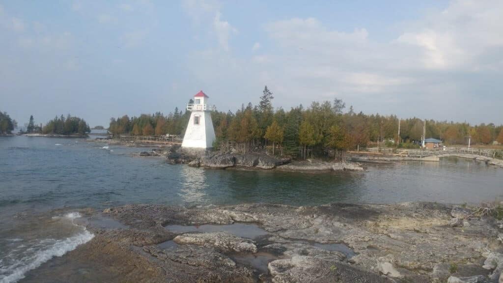
3. Tobermory
Tobermory is a small harbor town located on the north tip of the Bruce Peninsula.
It is situated at the junction of Lake Huron and Georgian Bay.
The area is known for its turquoise, crystal-clear waters surrounded by jagged cliffs.
It is a popular destination for outdoor activities such as hiking, kayaking, and scuba diving.
Also, Tobermory is renowned for its shipwrecks, with several underwater wrecks attracting divers from around the world.
Tobermory is a popular tourist destination, offering accommodations, restaurants, shops, and various attractions for visitors to enjoy.
Here is where you will board the Chi-Cheemaun Ferry, at the Tobermory Ferry Terminal.
🦄 I wrote an entire blog post dedicated to Tobermory. Therefore, if you want all the information on what to do and see in Tobermory, check out this blog post: How To Spend A Weekend In Tobermory. Also, I have this blog post: Are There Bears In Tobermory, Ontario?
👉 Check out this day trip: From Toronto: Bruce Peninsula National Park Guided Day Trip
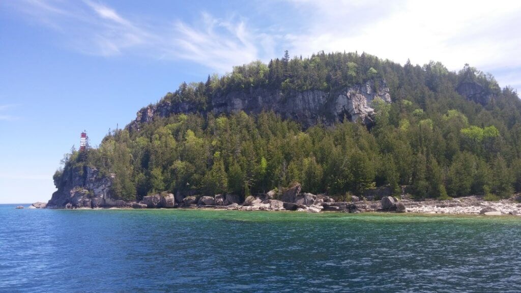
4. Flowerpot Island
Since you are already in Tobermory to catch the Chi-Cheemaun Ferry, you might as well check out Flowerpot Island.
Flowerpot Island, situated in Georgian Bay near the town of Tobermory, is a small island known for its distinctive geological features.
Its name comes from two remarkable rock formations shaped like flower pots.
They have been sculpted over time by the forces of erosion and weathering.
The island offers several hiking trails that allow visitors to explore its diverse landscapes, including forests and rocky shorelines.
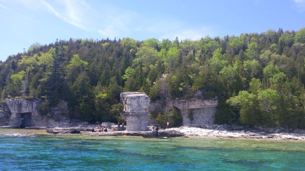
The most popular path guides visitors to the captivating Flowerpot formations, granting an up-close encounter with these remarkable geological marvels.
Moreover, the island has a historic lighthouse, contributing to its charm and commemorating its maritime legacy.
To access Flowerpot Island, visitors can hop on a boat tour departing from Tobermory.
Once on the island, travelers can engage in hiking adventures, have a picnic, and relish the breathtaking scenery that unfolds along the picturesque Georgian Bay.
5. Manitowaning
Manitowaning is a picturesque community situated on the northeastern shore of the island, overlooking Manitowaning Bay.
It is known as the first European settlement on Manitoulin Island.
The name “Manitowaning” is derived from the Ojibwe term “Manidoowaaning,” which means “the gathering place of the spirits.”
With its rich history and stunning natural surroundings, Manitowaning offers a unique blend of cultural heritage and scenic beauty.
The community has deep roots in Indigenous culture and is close to the historic Wikwemikong Unceded Indian Reserve.
It is one of the largest First Nations communities in Canada.
Manitowaning has a charming waterfront area, where you can stroll along the marina and enjoy views of the bay.
A point of interest is the Manitowaning Lighthouse and St. Paul Church (beside each other).
Also, close by, you will find High Falls.
In addition, the community has a strong focus on preserving its history and heritage.
Throughout the year, Manitowaning hosts various cultural events and festivals that celebrate its Indigenous heritage and showcase local arts, crafts, and traditions.
These events provide an opportunity to immerse oneself in the vibrant culture of the community and learn more about its history.
6. Misery Bay Provincial Park
Misery Bay Provincial Park is a stunning natural area located on the southwest shore of Manitoulin Island.
It is the only operating provincial park on Manitoulin Island and has 15 km of hiking trails.
Why is it called Misery Bay on Manitoulin Island?
Legend has it that in the early days of settlement, when the first pioneers arrived in the area surrounding Misery Bay, they faced a shortage of hay for their livestock.
In search of an alternative, they ventured to the bay’s edge to harvest marsh grass as a substitute.
During a hot June day in the 1880s, a pioneer was cutting marsh grass when two men in a small boat approached.
Curious about the location, the boaters called out, “What is this place called?”
Overwhelmed by the heat, exhaustion, and relentless black flies, the farmer responded, “I’m in misery!”
The farmer didn’t know that the men in the boat were government surveyors tasked with mapping the island.
Amused by the farmer’s exasperated reply, they jotted down the name “Misery” in their records, forever associating it with the bay.
The park encompasses approximately 1,080 hectares and features a variety of landscapes.
Those include wetlands, forests, and a scenic sandy beach.
Also, it is home to a rare Alvar ecosystem, known as Alvar grasslands or Alvar plains.
They are unique habitats characterized by thin or absent soil cover, exposed bedrock, and sparse vegetation.
These ecosystems typically occur on flat or gently sloping limestone or dolostone plateaus, often in regions with a cool and moist climate.
For hikers and nature lovers, Misery Bay Provincial Park has four well-maintained trails.
The trails vary in length and difficulty, accommodating both leisurely strolls and more challenging hikes ranging from 2 km to 8 km.
In addition, there is a Visitors Center that has educational exhibits and hands-on displays as well as washroom facilities.
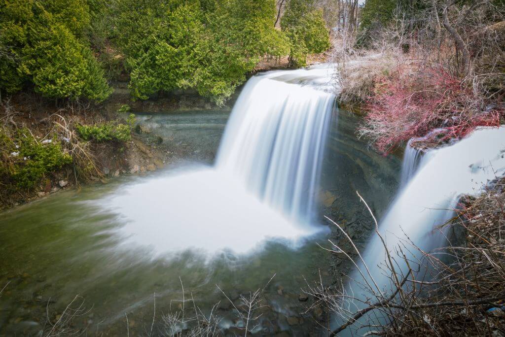
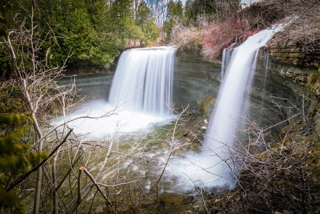
7. Bridal Vail Falls
Bridal Veil Falls is a beautiful waterfall located near the community of Kagawong.
It is one of the island’s natural gems and a popular attraction for visitors.
The waterfall gets its name from the way the water cascades down, resembling a delicate bridal veil.
Bridal Veil Falls is easily accessible, with a short walk from the parking area to the viewing platform.
The falls are fed by the Kagawong River, which originates from Lake Kagawong and empties out at Mudge Bay.
Bridal Veil Falls has a height of approximately 35 feet (10.7 meters), and there are a few observation areas around it.
Also, you can swim in the basin at the bottom of the falls on a hot day.
In addition, it is possible to go behind the falls and see it from behind, but keep in mind the rock will be slippery.
The surrounding trails offer further exploration options around the area.
What is there to do at Kagawong, other than the Bridal Veil Falls?
Kagawong is a charming village located on the northern coast of the island, overlooking the scenic waters of Lake Huron.
The name “Kagawong” is derived from the Ojibwe term “gagawabikaang,” meaning “bay of the mists.”
This name reflects the village’s picturesque location and the ethereal beauty of its surroundings.
One of the notable features of Kagawong is its waterfront area.
Visitors can enjoy leisurely strolls along the harbor and take in the beautiful views of the lake.
Kagawong has a rich history, which can be found in various heritage sites and landmarks.
The Kagawong Museum (temp closed) showcases artifacts and exhibits that delve into the area’s history, including its Indigenous heritage and early settler experiences.
The nearby restored stone gristmill, known as the Old Mill Heritage Centre (temp closed), is a fascinating attraction that provides insight into the region’s early milling industry.
Also, check out the Kagawong Lighthouse, which has served as a navigational aid and a symbol of the village for over a century.
The village is known for its vibrant arts community, with local artisans and craftspeople showcasing their work in galleries and studios.
Visitors can explore these creative spaces, discover unique pieces of artwork, and even participate in workshops or events held by the artistic community.
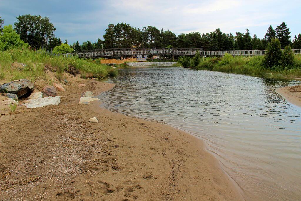
8. Providence Bay Beach
Providence Bay Beach is a pristine sandy beach situated on the south shore of Lake Huron.
It is one of the things to do in Manitoulin Island, Ontario.
The native inhabitants referred to the bay as “Bebekodawangog”, which can be translated as “where the beach curves around the water.”
Subsequently, the bay acquired its current name after a group of individuals, survivors of a shipwreck, found refuge on the beach.
They named the bay “Providence” as a testament to their deliverance.
Is Providence Bay Beach family-friendly?
Providence Bay Beach is known for its stunning natural beauty, tranquil atmosphere, and family-friendly environment.
Also, the beach’s shallow waters make it ideal for swimming and wading, especially for families with young children.
In addition, if you are traveling with kids, there is a large playground for them to enjoy.
The gradual slope and clear waters create a safe and enjoyable swimming experience.
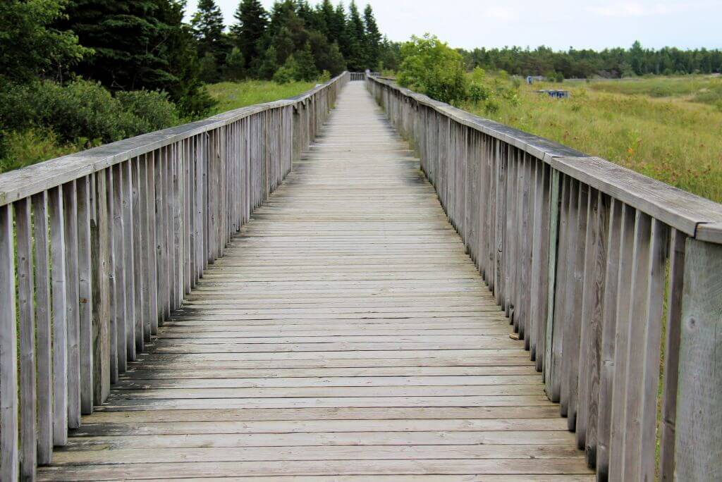
In addition, there is a long boardwalk that helps you see the entire beach and the surrounding area.
The expansive shoreline provides an excellent opportunity for beach volleyball, frisbee, or flying kites.
The beach is nestled within a beautiful bay, surrounded by rolling dunes and gentle hills.
These dunes are an integral part of the beach’s ecosystem and are home to unique plant species adapted to the sandy environment.
Exploring the nearby trails can provide insights into the local flora and fauna.
Amenities at Providence Bay Beach include picnic areas, public washrooms & changerooms, and ample parking spaces.
The beach is easily accessible, and its popularity as a summer destination ensures that it remains well-maintained and visitor-friendly.
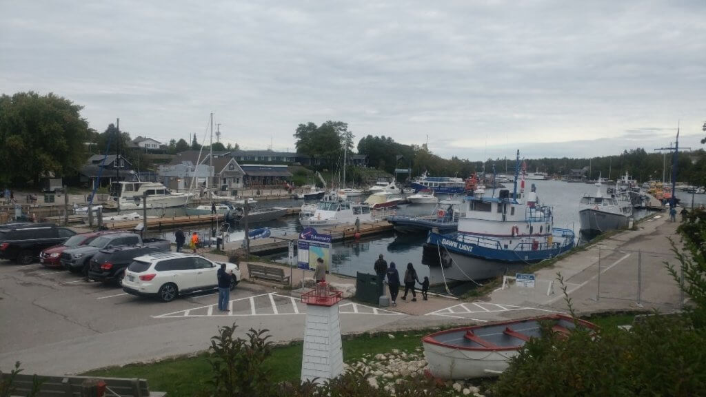
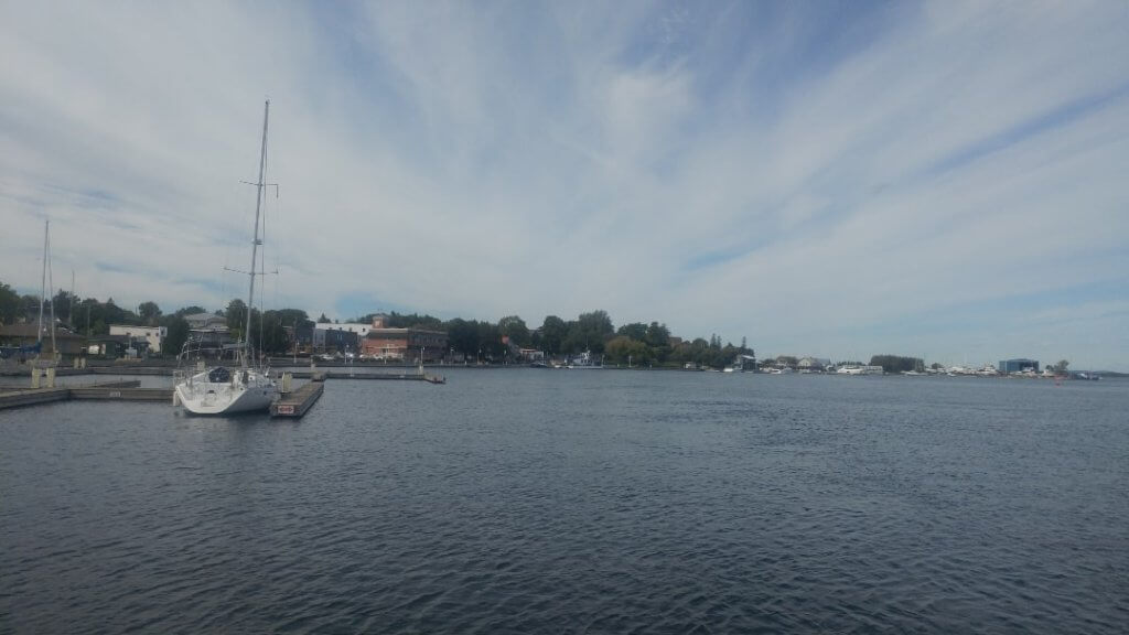
9. Little Current
The biggest town and administrative center on Manitoulin Island is the harbor community of Little Current.
It is located on the northeast tip of the island and has a population of around 1,200 residents.
Despite its size, it serves as a hub for services and amenities for both residents and visitors on the island.
The town is located on the North Channel, which separates Manitoulin Island from the mainland.
The town has various amenities, including grocery stores, restaurants, accommodations, and recreational facilities.
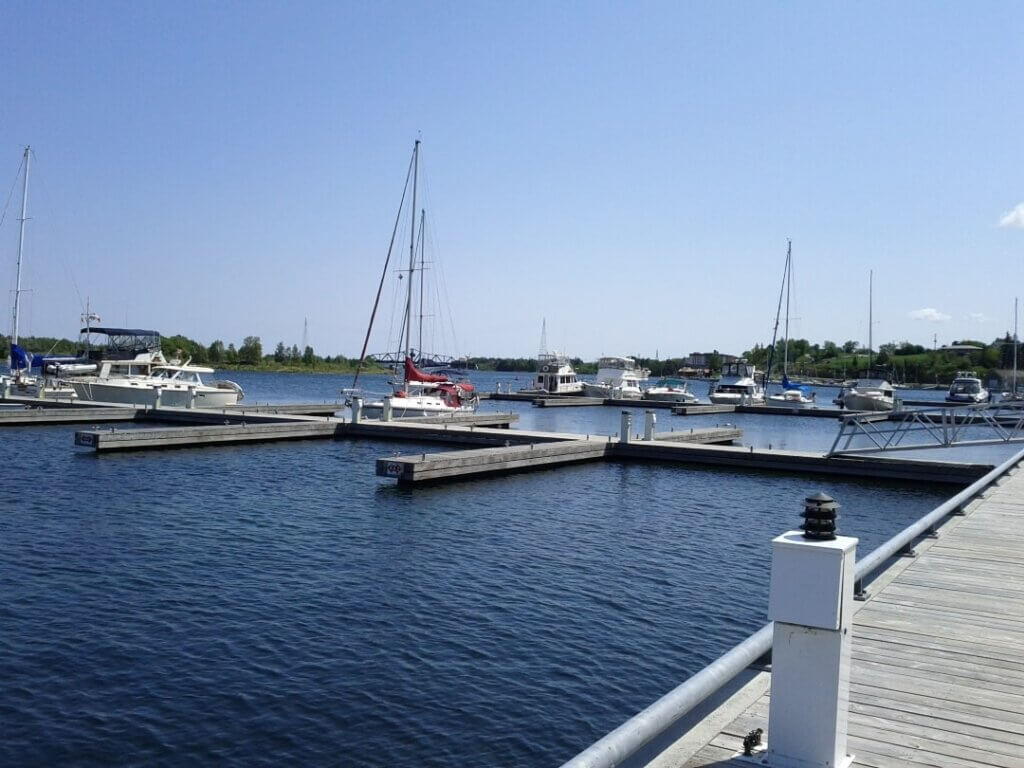
The area around Little Current is known for its natural beauty, with numerous lakes, forests, and scenic vistas.
There is a long boardwalk that runs along the marina, which makes for the perfect stroll.
The main street that runs parallel to the boardwalk has a lot of cool little shops.
Inside, you will find some original merch, funny decor pieces, and signs, as well as local treats such as jams, maple syrup, etc.
I love browsing through them, and somehow I always end up buying something.
Little Current offers a peaceful and picturesque setting to enjoy the natural wonders of Manitoulin Island and the North Channel region.
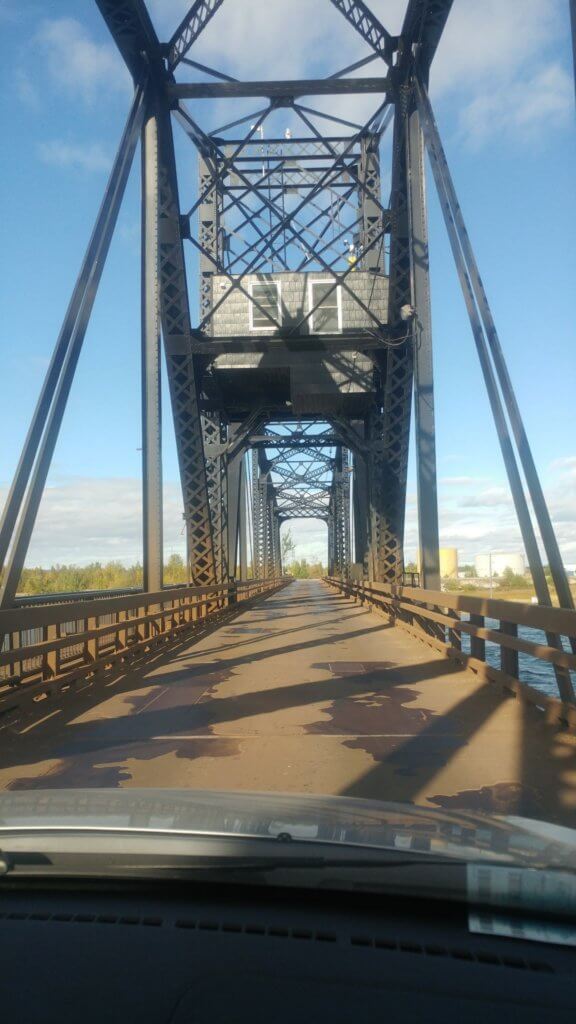
10. Swing Bridge
The main attraction in Little Current is the Swing Bridge, which goes over the North Channel.
The Swing Bridge is unique because it swings sideways and allows boat traffic to pass through.
When a boat needs to navigate through the channel, the bridge swings open horizontally to create an opening for the vessel to pass.
Once the boat has cleared, the bridge swings back into its original position, allowing pedestrians and vehicles to cross again.
This swinging mechanism is necessary because the North Channel is an important waterway.
It is used by boats and ships to navigate between Lake Huron and Georgian Bay.
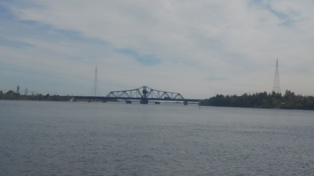
The bridge provides a convenient crossing point, ensuring that they can access Manitoulin Island without having to take a longer route around the island.
The Swing Bridge has become an iconic symbol of Little Current and Manitoulin Island, attracting tourists who are fascinated by its unique design and operation.
Can you drive on the Swing Bridge?
Regular cars are allowed to use the Swing Bridge.
However, larger vehicles, such as trucks and buses, are not permitted to cross the bridge due to the weight limitations of the swinging mechanism.
The bridge is a single lane only, and on each side of it, there are traffic lights to control the traffic (the only ones on the island). Therefore, each direction has its turn.
On the hour, the bridge closes for cars for about 15 minutes and then the bridge swings sideways to allow for any boats to cross.
It is over a hundred years old, and its mechanics are starting to fail. Therefore, there are rumours of building a newer, two-lane bridge in the near future to replace the existing one.
Walking around the boardwalk, we’ll give you some stunning views of the Swing Bridge.
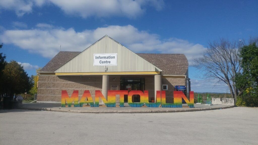
On your way to the bridge, don’t forget to stop and take a picture with the Manitoulin Sign, which is located in front of the Information Center.
Most people tend to stick their heads through the O when they take a picture.
Where To Eat On Manitoulin Island?
Since Little Current is the main town, let’s focus on the food places in it.
Located on the main street, you will find the Anchor (it is on the corner; it is hard to miss). Also, it doubles as an inn that provides accommodations.
It is a great place to stop and grab a bite. There is an inside portion of the restaurant as well as a large patio.
They serve burgers, salads, as well as other bar food.
Another restaurant to check out is Elliott’s, where you will find an extensive breakfast menu.
As well as a full dinner menu including tacos, wraps, fish, salads, flatbreads, etc.
Also, they have some vegetarian and gluten-free options.
If you’re looking for a place to grab some fast food and possibly ice cream, I would recommend 3 Cows and A Cone.
It has a lot of picnic benches where you can sit and enjoy the food. It is close to the Swing Bridge.

Where To Stay On Manitoulin Island?
Due to the remoteness of the island as well as the fact that it is mainly only nature, there are not many accommodations available.
Keep in mind that both properties are simple and unassuming; however, they are perfect for a night or two to spend on the island.
Hawberry Motel
Hawberry Motel is located on Highway 6 in Little Current, the main town on Manitoulin Island.
- Rooms are air-conditioned, non-smoking, with cable TV and a fridge
- Select rooms also feature a hair dryer, a microwave, and a coffee maker
- Also, free Wi-Fi is available throughout the property, as well as free private parking
- Close to the town center, boardwalk, and Swing Bridge, 23 km to the Cup and Saucer Trail, and 45 km to the Bridal Veil Falls.
👉 Check availability for your dates here: Hawberry Motel
Huron Sands Motel and Restaurant
If you prefer to be located closer to Providence Bay Beach, you should check out Huron Sands Motel and Restaurant.
- It has a restaurant, and free Wi-Fi in the rooms
- 400 meters from Providence Bay Beach
- Rooms have air conditioning, a TV with satellite channels, a microwave, and an electric kettle
- Also, there is free private parking, and pets are allowed, subject to an extra fee
👉 Check availability for your dates here: Huron Sands Motel And Restaurant
Map Of Things To Do On Manitoulin Island, Ontario
FAQs: Things To Do On Manitoulin Island, Ontario
Below are some of the frequently asked questions about Manitoulin Island, Ontario.
What is unique about Manitoulin Island?
Manitoulin Island is a unique destination for several reasons.
It holds the distinction of being the largest freshwater island in the world.
Manitoulin Island spans approximately 2,766 square kilometers (1,068 square miles).
It is home to several First Nations communities, including the Anishinaabe (Ojibwe), Odawa, and Pottawatomi.
The island is rich in Indigenous culture and history, with opportunities to learn about their traditions, art, and heritage through events, museums, and cultural centers.
The island has breathtaking natural beauty, characterized by lush forests, serene lakes, and stunning shorelines along the North Channel.
Visitors can explore the island’s numerous hiking trails, take in panoramic views, and immerse themselves in the peaceful surroundings.
What currency is used on Manitoulin Island?
The currency used on Manitoulin Island, like the rest of Canada, is the Canadian Dollar (CAD).
Due to the remoteness of the island, it is recommended to bring cash with you as ATMs, debit and credit card machines might not be available in all places.
How far is Manitoulin Island from Toronto?
The distance between Manitoulin Island and Toronto varies depending on the route taken.
The approximate driving distance from Toronto to Manitoulin Island is around 363.6 km (226 miles).
It typically takes about 5 to 6 hours, depending on traffic conditions and the chosen route.
The faster route is from Toronto, where you would head north on Highway 400 until reaching Highway 69.
You would then continue north on Highway 69 until reaching Sudbury.
From Sudbury, you would take Highway 17 westbound until reaching Espanola.
At Espanola, you would cross the Swing Bridge onto Manitoulin Island.
After reaching Manitoulin Island, the specific destination on the island would determine the exact travel distance.
The island is quite large, and various towns and communities are spread throughout its area.
Can you get to Manitoulin Island by car?
Yes, there are two ways to get to Manitoulin Island by car.
The first is the driving route mentioned above, which leads to the Swing Bridge.
The second one is the Chi-Cheemaun Ferry, which makes many daily trips between Tobermory (Bruce Peninsula) and South Baymouth (Manitoulin Island).
You can get on the ferry with your car (you must pre-book in advance).
👉 Rent a car in Toronto in order to get to Manitoulin Island
Is it worth going to Manitoulin Island?
It is worth visiting Manitoulin Island if you like picturesque lakes, forests, and scenic vistas.
Also, the island is rich in Indigenous culture and history, so if you are interested in learning more about their traditions, art, and heritage, it is worth visiting.
Overall, Manitoulin Island offers a unique blend of natural wonders, cultural richness, and outdoor activities.
🦄 Related blog post: 15 Things To Do In Wiarton, Ontario
Conclusion: 10 Things To Do On Manitoulin Island, Ontario
In conclusion, Manitoulin Island, Ontario, offers a multitude of activities and attractions that make it a captivating destination for visitors.
From its breathtaking natural beauty to its rich Indigenous culture and diverse outdoor opportunities, the island has something for everyone.
The Cup and Saucer Trail offers panoramic views, while Bridal Veil Falls entices with its cascading beauty.
It is a destination that showcases the natural beauty, cultural richness, and warm hospitality of Ontario’s largest freshwater island.